Westward Gold Begins Drilling Next to Barrick’s Cortez Complex Ahead of Proposed Nevada IPO
Westward Gold Announces Commencement of Drilling & Provides Update on Field Activities at the Toiyabe Hills Property, Nevada
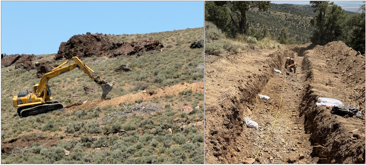
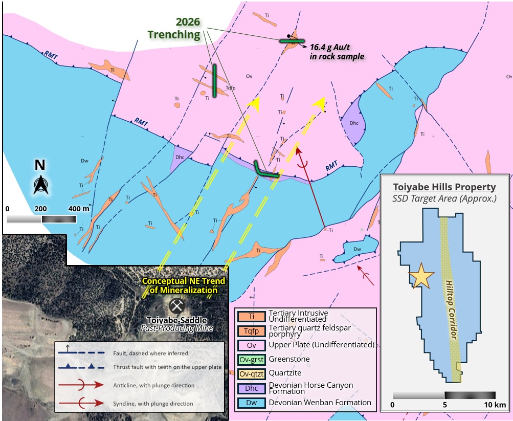
Vancouver, British Columbia, June 22, 2026 – TheNewswire – Westward Gold Inc. (CSE: WG, OTCQB: WGLIF, FSE: IM50) (“Westward” or the “Company”) is pleased to provide an update on field activities at the Company’s Toiyabe Hills Property in Lander County, Nevada (“Toiyabe Hills”, or the “Property”), where drilling has just commenced and numerous additional exploration programs are currently ongoing. Following the recent receipt of a Work Plan Concurrence from the U.S. Bureau of Land Management (“BLM”), trenching activities were completed at the SSD Target (“SSD”), one of three zones slated for core and reverse-circulation (“RC”) drilling in 2026 (see press release dated April 27, 2026, for an in-depth review of SSD). The Company has just begun drilling at SSD following delivery of a core rig to site, with two RC rigs to follow in the months ahead from National EWP and Legacy Drilling. Additional large-scale programs to be completed this year include 1:5000 surface mapping, geochemical sampling, and multiple geophysical surveys; details and status updates on each are provided below. 2026 Trenching Program (SSD Target)A 468-metre trenching program has just been completed at the SSD Target (see Figures 1 and 2 below), designed to more accurately sample and map structures ahead of drilling; this data will contribute to the final determination of drill hole dips / azimuths from certain planned drill sites. High-grade structures – including the dike containing a 16.4 g Au/t sample – will be projected down-section based on mapped dips and strikes, and drills will be aimed to intersect these structures within favourable carbonate host rocks (notably of the Wenban Formation). These settings typically represent the best potential for significant zones of gold mineralization in Carlin-type systems along the major trends of northern Nevada. Figure 1: SSD Target – 2026 Trenching Program
Figure 2: SSD Target – 2026 Trenching Program Photos
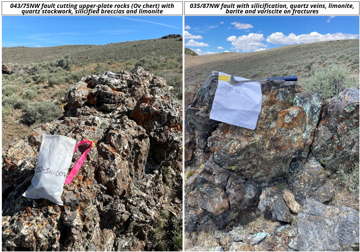
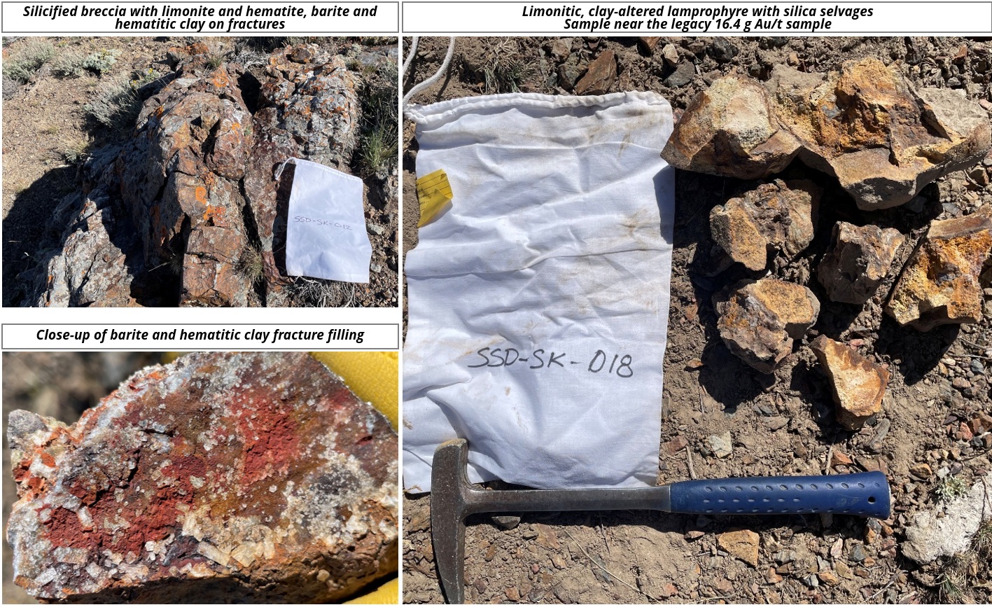
Surface Mapping ProgramThe Company’s 1:5000 Anaconda-style surface mapping program has been ongoing since the beginning of the field season, and continues to form a vital part of Westward’s systematic exploration and targeting strategy. This year will see the greatest amount of new coverage ever, with three expert mappers advancing multiple folios concurrently (including recent land expansions to the north and south) – Steve Koehler (Technical Advisor), Robert Edie (VP Exploration), and Tom Chapin (Contractor). The program has already generated important new findings, notably moving north at the SSD Target and over newly-acquired ground at the southern end of the Property:
Figure 3: Select Photos – 2026 Mapping & Sampling (Northern SSD Target Area)
Figure 4: Select Photos – 2026 Mapping & Sampling (Northern SSD Target Area)
Geochemical Sampling ProgramsThe Company’s robust 2026 geochemical sampling programs are adding to an already expansive database built over the last several years, and will include the following:
Geophysical SurveysThree significant geophysical surveys are being conducted by the Company in 2026 – forming another pillar of its systematically-gathered baseline exploration data. As in previous years, all results are being interpreted by Mr. Jim Wright of J.L. Wright Geophysics in Spring Creek, NV – a renowned geophysicist with over 40 years of expertise within the Carlin and Cortez Districts of northern Nevada – in coordination with Westward’s team of technical experts. This year’s programs include the following:
Qualified PersonThe technical information contained in this news release was reviewed and approved by Robert Edie, Vice President Exploration of the Company, who is a Qualified Person under National Instrument 43-101 – Standards of Disclosure for Mineral Projects. Mr. Edie is a Certified Professional Geologist (CPG) through the American Institute of Professional Geologists (AIPG). About Westward GoldWestward Gold is a mineral exploration company focused on developing the Toiyabe Hills Project located in the Cortez Trend area of Lander County, Nevada, and the Coyote and Rossi Projects located along the Carlin Trend in Elko County, Nevada. From time to time, the Company may also evaluate the acquisition of other mineral exploration assets and opportunities.
Past performance is not an indicator of future returns. NIA is not an investment advisor and does not provide investment advice. Always do your own research and make your own investment decisions. NIA has received compensation from WG of US$60,000 cash for a six-month marketing contract. This message is meant for informational and educational purposes only and does not provide investment advice. |