SAGA’s First Diamond Drill Hole Intersects 169 Metres of Prospective REE-Bearing Unit at Wolverine
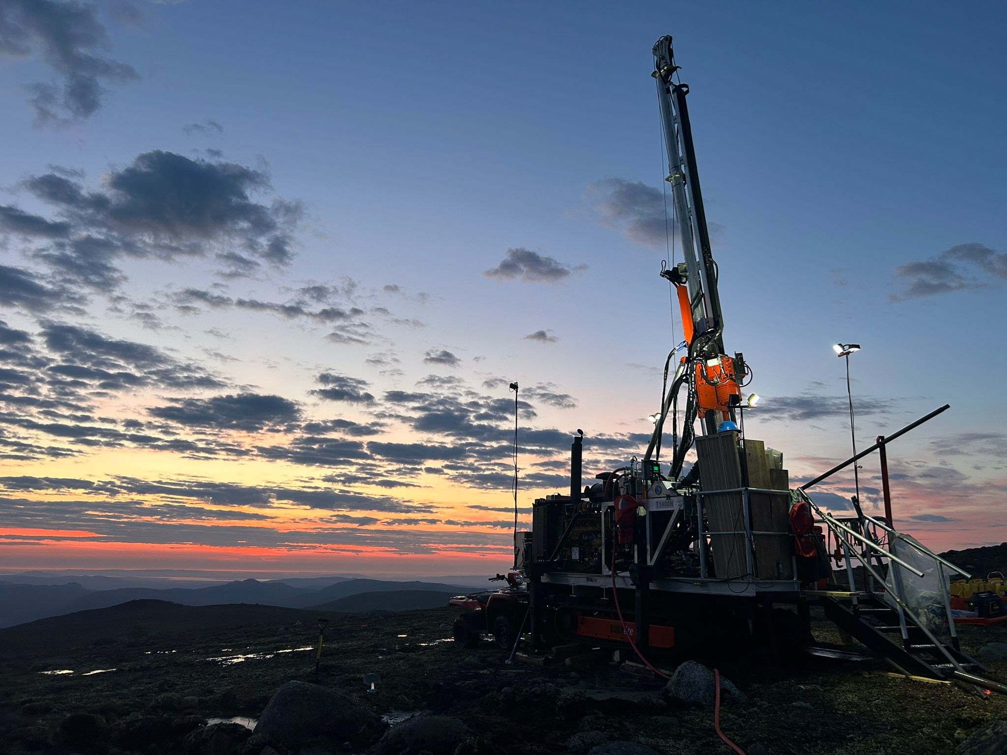
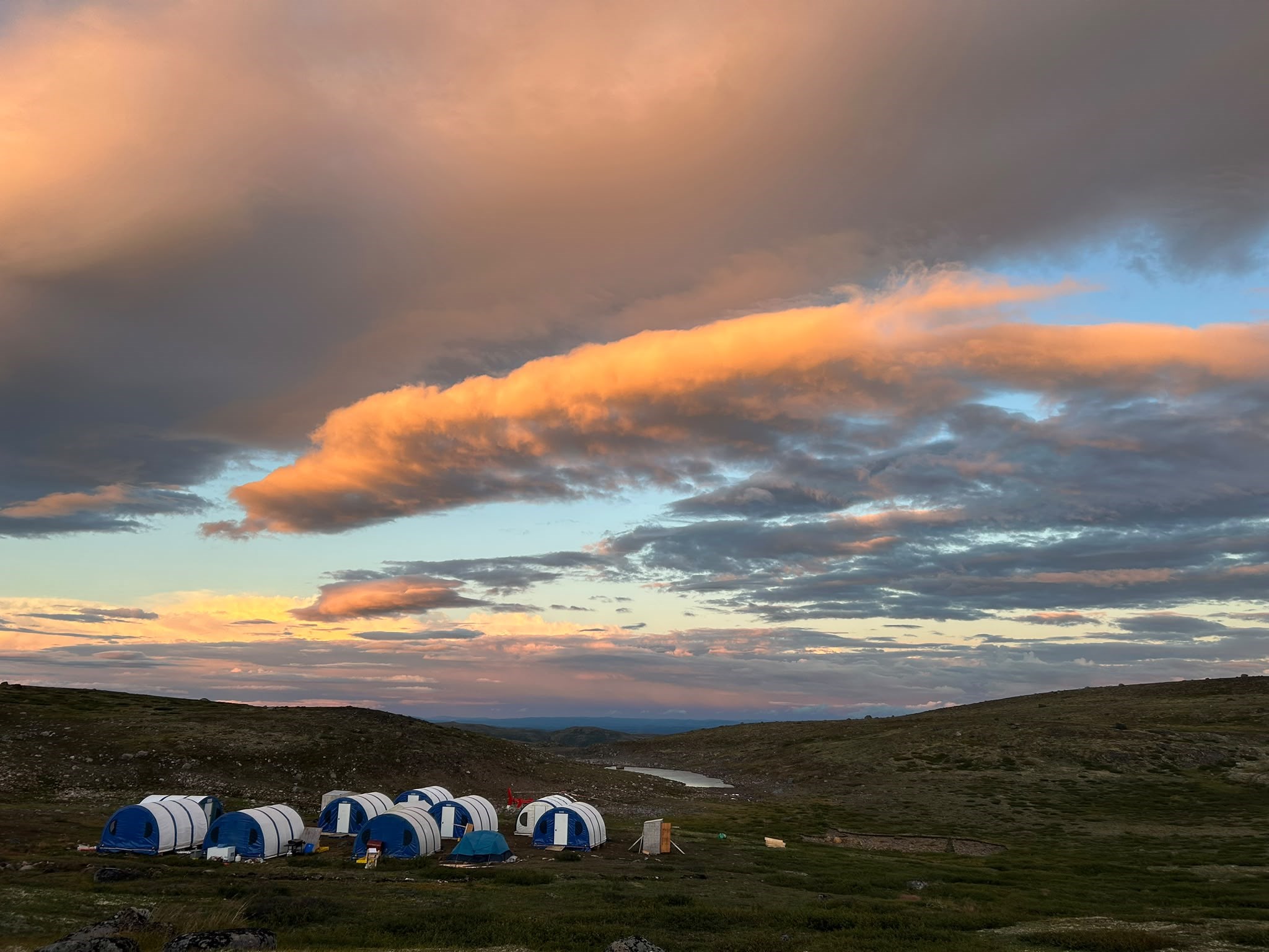
Vancouver, British Columbia—(September 2, 2026) – SAGA Metals Corp. (TSXV: SAGA) (OTCQX: SAGMF) (FSE: 20H) (“SAGA” or the “Company”), a North American exploration company focused on critical mineral discoveries, is pleased to announce that diamond drilling has commenced at its 100%-owned Wolverine Heavy Rare Earth Element (“HREE”) Project in central Labrador, Canada.
Camp construction, crew mobilization, and supporting infrastructure are complete. A diamond drill program of up to 5,000 metres is now underway. The program is designed with four components that will be fully integrated: 1) detailed mapping of the previous identified mineralized zone to define the volcanic stratigraphy and alteration associated with heavy rare earth mineralization, 2) grid pattern diamond drilling with holes on 100 meter centres with 200m step outs along strike and down dip to confirm and extend mineralization in the sub horizontal mineralized volcanic unit 3) evaluation of other high priority prospects and 4) determination of mineralized rock properties, geochemistry and metallurgical testing to advance the project toward a maiden NI 43-101 mineral resource estimate.
SAGA Metals has completed the first two drill holes (W26-001, W26-002) on its Wolverine REE project and first ever diamond drill hole on the property to date. The depth of that first sub vertical drill hole was 182 meters including 169 meters of the shallowly dipping prospective REE-bearing volcanic ash tuff unit. Historic pack sack diamond and rotary drilling did not exceed 50 meters depth across property and only 36 meters into the prospective REE-bearing unit in the area of SAGA’s initial drill hole. The second hole (176 meters EOH) intersected the same stratigraphy and alteration markers despite a 200 meter step out along strike from W26-001.
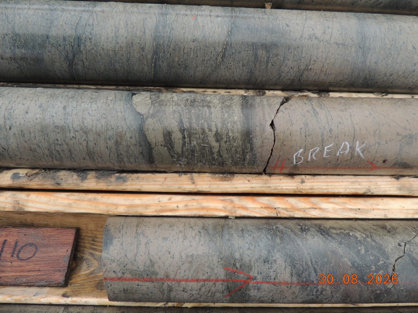
Core logging identified alteration in the volcanic unit overlying the prospective REE-bearing volcanic unit and through the prospective REE-bearing volcanic unit. The exploration objective was to delineate the stratiform and stratibound REE-mineralization in the prospective volcanic unit. However, a second mineralization style was identified in the prospective volcanic unit: sub vertical breccia-fracture networks, oriented to the core axis, with related conjugate fracture sets are filled and lined by sulphide+chlorite. Veins display chloritic wall rock salvages and banding (Figure 4).
The latter mineralization style is considered highly significant as the altered structure identifies a new sub vertical exploration target and identifies the potential for defining a depth potential to REE mineralization across the Wolverine property. The sub vertical breccia-fracture networks provided the pathway for up flow of hydrothermal fluid through the volcanic pile and subsequently lateral migration into the sub horizontal volcanic unit.
Consequently, SAGA’s main exploration target, thick stratiform and stratibound alteration is confirmed and a second new structurally-controlled exploration target has been identified. Geological mapping has identified additional altered fault zones within the prospective volcanic unit peripheral to the area of the current grid diamond drill program. The recognition of intense propylitic-to-acidic hydrothermal alteration, chlorite+pyrite, in both the stratiform and stratibound and structurally-controlled volcanic unit are the products of a hydrothermal fluid that is capable of transporting and depositing high-value critical metals.
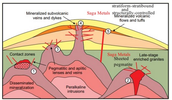
There are many examples throughout the world of peralkaline intrusions and related pegmatites having been enriched and prospective for rare earth elements and high field strength elements: zirconium, hafnium, niobium, tantalum, thorium, uranium, yttrium. SAGA’s exploration for REE mineralization in shallowly dipping volcanic rocks identifies a little explored for mineral deposit type within the family of ore deposits formed by peralkaline magmas. Analogous stratiform deposits hosted in peralkaline volcanic rocks are Pennington Mountain, Maine, USA (tonnage unknown) and Brockman (Hastings) Deposit, Western Australia (JORC Mineral Resource of 29.93 million tonnes at 0.93% TREO (www.rare-earth-mining.com/hastings-technology-metals/, 2026)).
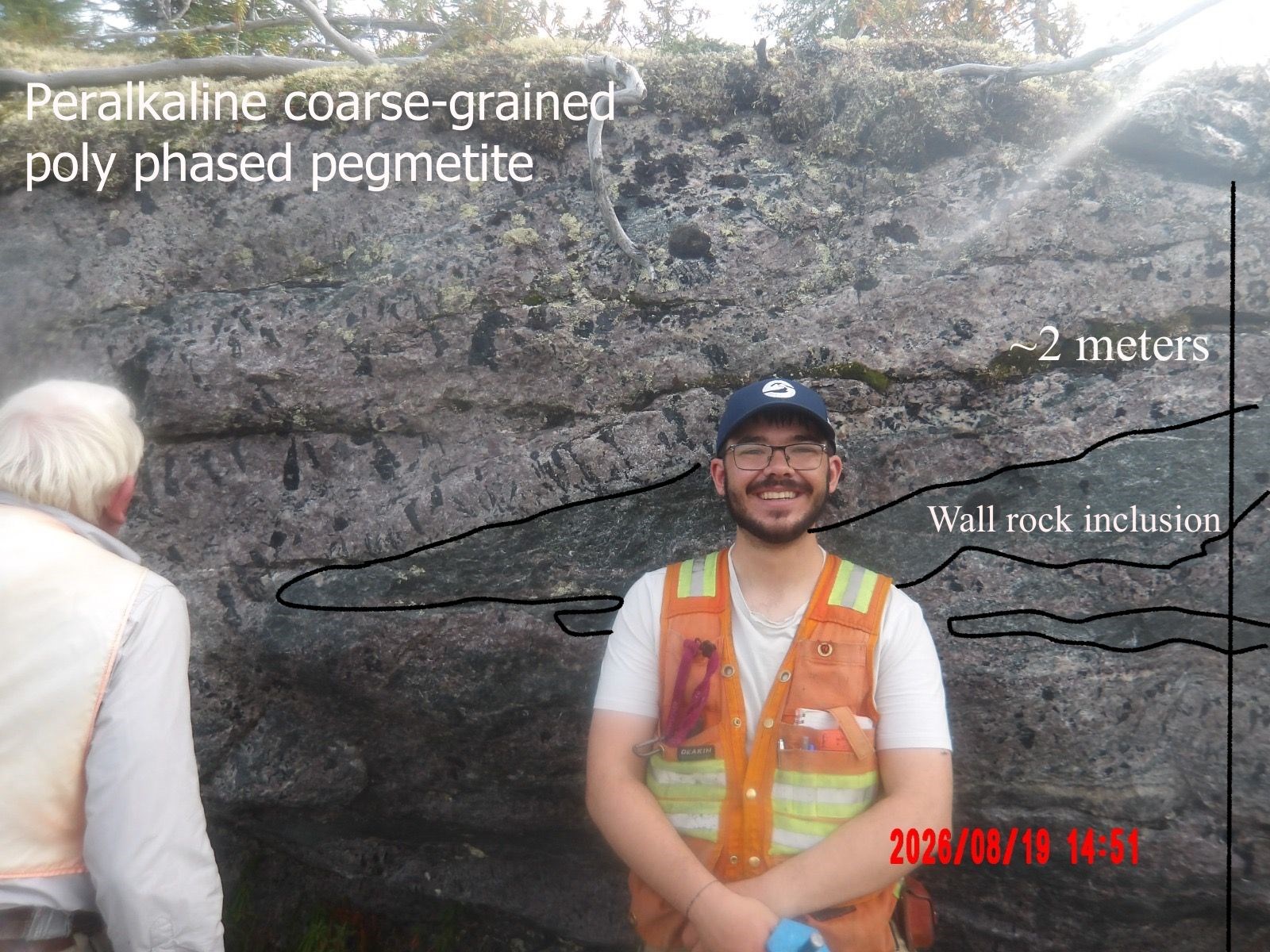
Prospecting in the southeast area of the property focused on REE-bearing pegmatite, having values up to 21% TREO hosted in peralkaline granite. Pegmatite is exceptionally coarse-grained and occurs as poly generation, sub horizontal, sheeted pegmatite swarm in coarse grained peralkaline granite. The REE deposit model for ongoing exploration is sheeted pegmatite swarms within the uppermost part of a volatile-enriched peralkaline magma chamber (Figures 3, 5).
Michael Garagan, Chief Geological Officer and Director of SAGA Metals, commented:
“It is an extraordinary thing to be on this ground, working in the well preserved Nukliavik volcanic-hydrothermal system instead of chasing isolated showings can already be described as a complete geological privilege. We can now correlate the same chlorite-pyrite replacement we saw in the 2025 RC chips in the diamond core, match the alteration halo metre by metre. Mapping and tracking that system at depth is going better than we expected. W26-001 looks like the cool, upper end of the feeder. The job from here is to prove the footprint first, then follow the structures down to the hot end, where the heavy REE typically live. The camp is setup, mapping is validating a robust mineralized footprint, and drilling is aiming to prove out a large deep system of heavy rare earths.”
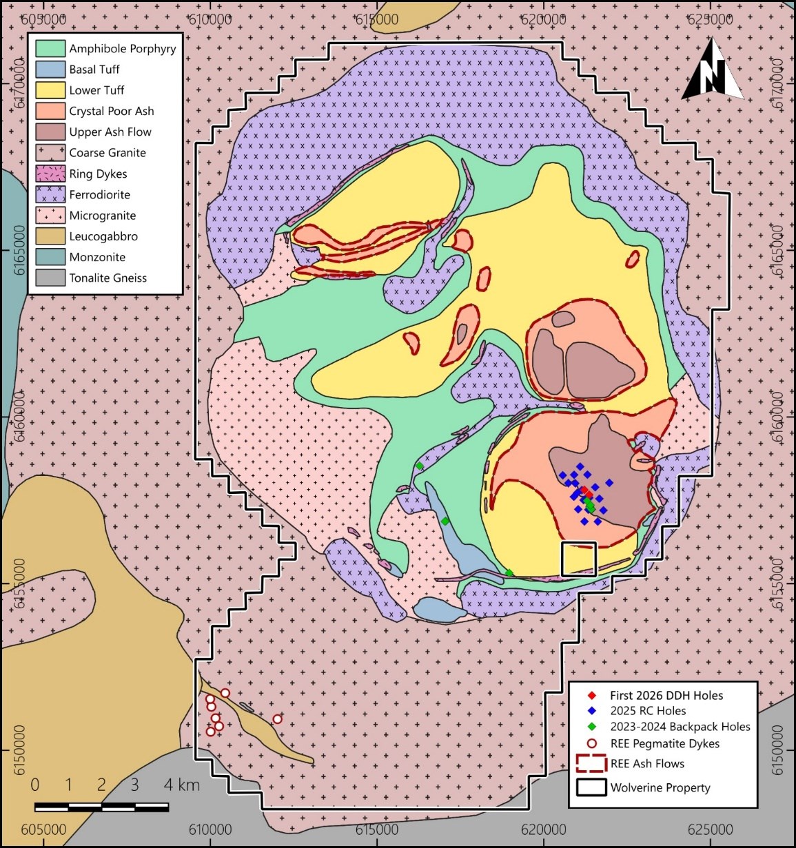
The 2026 diamond program will first establish the aerial extent of the shallowly dipping mineralized and altered prospective volcanic unit, then drill test the sub vertical structures for the potential and distribution between light and heavy rare earth elements (Figure 6).
The proposed mineral deposit model is that late faulting of the volcanic pile within the within the caldera created conduits for the vertical transmission of a REE-bearing hydrothermal fluid derived from a volatile-enriched peralkaline granite to migrate laterally in selected stratigraphic units in the volcanic sequence.
Historic exploration defined a sub-horizontal REE exploration target in the volcanic tuff. W26-001 extended the exploration potential by defining a greater width to alteration in the prospective unit and identifying a sub vertical exploration target along the feeder faults.
The program builds on 25 reverse-circulation (“RC”) holes completed in 2025, which confirmed broad, near-surface REE mineralization across a roughly 1.7 km by 1.2 km area, including 48.8 m at 0.77% TREO from 1.5 m in WOLRC25-003 and a peak assay of 2.03% TREO, with heavy rare earth oxides contributing approximately 24-28% of TREO. Surface sampling on the expanded land package has returned grades of up to 21.6% TREO. Those results are historical context only; they are not results from W26-001.
- Continue step-out and down-dip diamond drilling defining alteration in the prospective volcanic unit and related structures
- Systematic sampling and assay of W26-001 and subsequent holes
- Compile the alteration intensity and styles with structure to vector towards the deeper parts of the hydrothermal system
- Detailed core logging, structural measurements, and alteration mapping along with rock properties, assays and QA/QC datasets required to support a future maiden mineral resource estimate
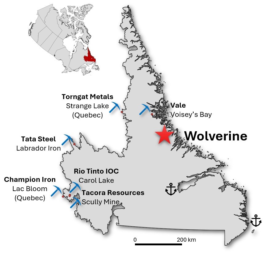
The Wolverine REE Project now comprises nine (9) contiguous mineral licenses totalling approximately 294.5 km², situated approximately 50 km west of Hopedale and 12 km inland from the Labrador coast (Figure 7). The project is accessible by fixed-wing aircraft to the Hopedale gravel airstrip, followed by helicopter to site. Infrastructure advantages include commercial air services, ferry services, and road access in the towns of Natuashish and Hopedale, with communities that have established agreements with the nearby Vale Voisey’s Bay mine. The project is only 12 km from tidewater, offering logistical support to potential year-round access.
- The Wolverine REE project lies within the peralkaline Flower Lake Igneous Suite, an intrusive-volcanic complex that is part of the 1.28- to 1.13-billion-year-old Gardar rifting province, the latter hosts globally significant REE deposits: Tanbreez within the Ilímaussaq alkaline intrusive complex and Strange Lake within a peralkaline granite.
- The project which includes a contiguous 29,450 hectares has district-scale potential, HREE enrichment, near-surface mineralization, and Tier-1 jurisdiction positions it as a potentially significant strategic REE asset.
- 2025 reverse circulation (“RC”) drilling confirmed broad, near-surface REE mineralization across a 1.7 km × 1.2 km area hosted within a significant peralkaline caldera system.
- 537 samples from the 2025 program returned consistent mineralization, supporting strong continuity across the drilled footprint. Key intercepts include:
- WOLRC25-003: 48.8 m @ 0.77% total rare earth oxides (“TREO*”) from 1.5 m, including 18.3 m @ 1.06% TREO
- WOLRC25-006: 38.1 m @ 0.71% TREO from surface, including 4.6 m @ 1.53% TREO
- WOLRC25-002: 51.8 m @ 0.52% TREO from surface, including 33.5 m @ 0.67% TREO
- RC drill program assays reached 2.03% TREO (WOLRC-006-25 – Sample 2355079 from 1.5-3 m), with an average heavy rare earth oxides (“HREO”) contribution of approximately 24-28%, highlighting strong heavy rare earth enrichment.
- Large-scale potential is supported by 26 km² of exposed mineralized tuff at surface, with depths of only 25-50 m, and less than 5% of the prospective unit drilled to date.
- Mineralization remains open and under-explored, with >1% TREO enriched zones identified
- In the southwestern area of the Project, seven (7) REE-bearing peralkaline pegmatites have been identified (Figure 3, 5).
- Thirty-nine (39) grab sample returned assays up to 21.6% TREO.
Dr. A. Miller, P. Geo., PEGNL is an Independent Qualified Person as defined under National Instrument 43-101 and has reviewed and approved the technical information disclosed in this news release.
A survey of the previous exploration drill holes was completed using a Differential Global Positioning System (“DGPS”) using a Emlid Reach RS2+. The RS2+ is a global navigation satellite system (“GNSS”) receiver that offers high-precision positioning. GNSS is a term that refers to the International Multi-Constellation Satellite System, which includes GPS, GLONASS, Baidu, Galileo, and any other constellation system. GPS traditionally refers to the American global positioning system. Differential correction techniques are used to enhance the quality of location data gathered using GNSS or GPS receivers. This data is beneficial to accurately and precisely locate drill collars, to verify historic work, as well as increase confidence in mineral resource estimates.
The GT RC drill was powered by two air compressors. Drill holes could be drilled up to an angle of -60° and 60m depth dependent on ground conditions, where the 2025 holes were drilled at a dip of -80°. Cased hole diameter is 4½” and open hole diameter is 3¾”. Drill was operated by a two-person crew on a 1 x 12h shift per day schedule.
Compass Group geologists, Michael Ives-Ruyter and Alex Ovas, were onsite for marking drill sites and logging drill chips. Samples were prepared onsite with a splitter and bagged. Archive material was collected in chip trays, as well as in small kraft bags. Large archive samples were collected in 1-2kg bags and stored in Happy Valley-Goose Bay, Labrador. Samples for analysis were shipped to Activation Laboratories Ltd (“ActLabs”) in Ancaster, Ontario. Check chip logging was completed by Clinton Davis in Ottawa, Ontario.
In total, 536 chip samples, 13 Standards (STD CDN-RE-1203), and 35 Blanks were collected. The standard used for QA/QC was CDN-RE-1203 certified by CDN Resource Laboratories Ltd and prepared using ore supplied by Canadian International Minerals from the Carbo property of the Copley Range in central BC. Blanks were inserted at the end of every hole as well as every 50 samples in sequence offset from Standards. Standards were inserted every 50 samples as well as additional randomized to have at least one standard on every second hole (Table 1).
| Hole ID | Easting | Northing | Elev | Date | Az | Dip | Depth (m) |
|---|---|---|---|---|---|---|---|
| WOLRC-25-001 | 621523 | 6157020 | 576 | Jul 10-11 | 220 | 80 | 36.6 |
| WOLRC-25-002 | 621425 | 6157004 | 567 | 11-Jul | 40 | 65 | 51.8 |
| WOLRC-25-003 | 621468 | 6157108 | 561 | Jul 13-14 | 220 | 65 | 50.3 |
| WOLRC-25-004 | 621266 | 6157301 | 565 | Jul 14-15 | 220 | 80 | 6.1 |
| WOLRC-25-005 | 621267 | 6157302 | 565 | Jul 15-16 | 220 | 80 | 33.5 |
| WOLRC-25-006 | 621347 | 6157342 | 559 | Jul 17-19 | 220 | 80 | 38.1 |
| WOLRC-25-007 | 621450 | 6157370 | 570 | 20-Jul | 220 | 80 | 44.2 |
| WOLRC-25-008 | 621218 | 6157601 | 586 | 21-Jul | 220 | 80 | 36.6 |
| WOLRC-25-009 | 621396 | 6158050 | 538 | 22-Jul | 220 | 80 | 22.9 |
| WOLRC-25-010 | 621167 | 6158302 | 577 | 23-Jul | 220 | 80 | 22.9 |
| WOLRC-25-011 | 620994 | 6158046 | 575 | 24-Jul | 220 | 80 | 16.8 |
| WOLRC-25-012 | 620644 | 6158051 | 564 | 25-Jul | 220 | 80 | 30.5 |
| WOLRC-25-013 | 620812 | 6157804 | 566 | 26-Jul | 220 | 80 | 3.1 |
| WOLRC-25-014 | 620812 | 6157805 | 567 | 26-Jul | 220 | 80 | 22.9 |
| WOLRC-25-015 | 621017 | 6157799 | 585 | 27-Jul | 220 | 80 | 39.6 |
| WOLRC-25-016 | 621068 | 6157505 | 598 | 28-Jul | 220 | 80 | 27.4 |
| WOLRC-25-017 | 620974 | 6157394 | 597 | 29-Jul | 220 | 80 | 39.6 |
| WOLRC-25-018 | 621107 | 6157017 | 535 | 30-Jul | 218 | 80 | 30.5 |
| WOLRC-25-019 | 621294 | 6156655 | 495 | 1-Aug | 220 | 80 | 27.4 |
| WOLRC-25-020 | 621696 | 6156652 | 514 | Aug 1-2 | 220 | 80 | 24.4 |
| WOLRC-25-021 | 621861 | 6156989 | 543 | Aug 2-4 | 220 | 80 | 42.7 |
| WOLRC-25-022 | 621743 | 6157341 | 540 | 4-Aug | 220 | 80 | 10.7 |
| WOLRC-25-023 | 621742 | 6157340 | 540 | Aug 4-7 | 226 | 80 | 49.1 |
| WOLRC-25-024 | 621617 | 6157683 | 551 | 6-Aug | 220 | 80 | 51.8 |
| WOLRC-25-025 | 622041 | 6157815 | 537 | 7-Aug | 218 | 80 | 57.9 |
| Hole | UTM E | UTM N | Az | Dip | Total (m) | Date from | Date to |
|---|---|---|---|---|---|---|---|
| VWS23-001 | 6E+05 | 6E+06 | 126 | 85 | 1.85 | 19-Sep-23 | 19-Sep-23 |
| VWS23-002 | 6E+05 | 6E+06 | 198 | 85 | 5 | 21-Sep-23 | 21-Sep-23 |
| VWS23-003 | 6E+05 | 6E+06 | 285 | 85 | 5.3 | 22-Sep-23 | 23-Sep-23 |
| VWS23-004 | 6E+05 | 6E+06 | 240 | 85 | 4.65 | 24-Sep-23 | 24-Sep-23 |
| VWS23-005 | 6E+05 | 6E+06 | 92 | 52 | 3.7 | 25-Sep-23 | 25-Sep-23 |
| VWS23-006 | 6E+05 | 6E+06 | 160 | 85 | 3.25 | 27-Sep-23 | 27-Sep-23 |
| VWS23-007 | 6E+05 | 6E+06 | 180 | 65 | 0.6 | 28-Sep-23 | 28-Sep-23 |
| VWS23-008 | 6E+05 | 6E+06 | 172 | 85 | 1.1 | 28-Sep-23 | 28-Sep-23 |
SAGA Metals Corp. is a North American mining company focused on the exploration and discovery of a diversified suite of critical minerals that support the North American transition to supply security. The 100% owned Radar Ti-V-Fe Project comprises 24,175 hectares and entirely encloses the Dykes River intrusive complex, mapped at 160 km² on the surface near Cartwright, Labrador. Exploration to date, including 24,641 m of drilling in the Hawkeye and Trapper zones, has confirmed a large, mineralized layered mafic intrusion hosting vanadiferous titanomagnetite (VTM) and ilmenite mineralization with consistently uniform grades of titanium, vanadium and iron.
The 100% owned Wolverine Heavy Rare Earth Element Project in Labrador, is a near-surface REE system hosted within a peralkaline caldera complex that shares strong geological similarities with the Tanbreez and Strange Lake deposits. Historic drilling identified consistent mineralization with assays up to 2.03% TREO including approximately 28% HREO and grab sample assays up to 21.6% TREO. Large scale potential is supported by 26 km² of exposed mineralization tuff at surface with about 5% of the prospective unit drilled to date.
The 100% owned Double Mer Uranium Project covers 25,600 hectares and features uranium radiometrics that highlight an 18 km east-west trend, with a confirmed 14 km section producing samples as high as 0.428% U3O8. (2024 Double Mer Technical Report).
Additionally, SAGA owns the Legacy Lithium Project in Quebec’s Eeyou Istchee James Bay region. This project spans 72,701 hectares and has geological attributes similar to nearby terrains currently being explored by Rio Tinto, Li-FT Power, SOQUEM, and Loyal Metals.
With a portfolio spanning key commodities critical to the clean energy future, SAGA is strategically positioned to play an essential role in securing critical minerals.
On Behalf of the Board of Directors
Mike Stier, Chief Executive Officer
For more information, contact:
Rob Guzman, Investor Relations
SAGA Metals Corp.
Tel: +1 (844) 724-2638
Email: rob@SAGAmetals.com
www.SAGAmetals.com
This news release contains forward-looking statements within the meaning of applicable securities laws that are not historical facts. Forward-looking statements are often identified by terms such as “will”, “may”, “should”, “anticipates”, “expects”, “believes”, and similar expressions or the negative of these words or other comparable terminology. All statements other than statements of historical fact, included in this news release are forward-looking statements that involve risks and uncertainties. In particular, this news release contains forward-looking information pertaining to the Company’s plans and expectations regarding the Wolverine REE Project, including the 2026 work program with respect to same and the potential publication of a mineral resource estimate. There can be no assurance that such statements will prove to be accurate, and actual results and future events could differ materially from those anticipated in such statements. Important factors that could cause actual results to differ materially from the Company’s expectations include, but are not limited to, changes in the state of equity and debt markets, fluctuations in commodity prices, delays in obtaining required regulatory or governmental approvals, environmental risks, limitations on insurance coverage, inherent risks and uncertainties involved in the mineral exploration and development industry, particularly given the early-stage nature of the Company’s assets and the Wolverine REE Project, and the risks detailed in the Company’s continuous disclosure filings with securities regulators from time to time, available under its SEDAR+ profile at www.sedarplus.ca. The reader is cautioned that assumptions used in the preparation of any forward-looking information may prove to be incorrect. Events or circumstances may cause actual results to differ materially from those predicted, as a result of numerous known and unknown risks, uncertainties, and other factors, many of which are beyond the control of the Company. The reader is cautioned not to place undue reliance on any forward-looking information. Such information, although considered reasonable by management at the time of preparation, may prove to be incorrect and actual results may differ materially from those anticipated. This cautionary statement expressly qualifies forward-looking statements contained in this news release. The forward-looking statements contained in this news release are made as of the date of this news release, and the Company will update or revise publicly any of the included forward-looking statements only as expressly required by applicable law.
Mineral exploration and development are highly speculative and are characterized by a number of significant inherent risks, which may result in the inability to successfully develop projects for commercial, technical, political, regulatory or financial reasons, or if successfully developed, may not remain economically viable for their mine life owing to any of the foregoing reasons. There is no assurance that the Company will be successful in achieving positive exploration outcomes on the Wolverine REE Project, and the likelihood of success must be considered in light of the early stage of operations, as the Company has currently conducted none of its own exploration of the project. Similarly, references herein to projects which share or may share similar characteristics with the Wolverine REE Project are based on SAGA’s review of publicly available information in respect thereof, and are at significantly more mature stages of development, and are accordingly subject to unknown uncertainties regarding actual equivalence.
The Company’s ability to identify valuable resources in sufficient quantity and quality to justify continued exploration, development activities and/or its ability to commence and complete development work and/or commence and/or sustain commercial production operations will depend upon numerous factors, many of which are beyond its control, including exploration success, the obtaining of funding for all phases of exploration, development and commercial mining, the adequacy of infrastructure, geological characteristics, metallurgical characteristics of any deposit, the availability of processing technology and capacity, the availability of storage capacity, the supply of and demand for REEs and other minerals, the availability of equipment and facilities necessary to commence and complete development, the cost of consumables and mining and processing equipment, technological and engineering problems, accidents or acts of sabotage or terrorism, civil unrest and protests, currency fluctuations, changes in regulations, the availability of water, the availability and productivity of skilled labour, the receipt of necessary consents, permits and licenses (including mining licenses), and political factors, including unexpected changes in governments or governmental policies towards exploration, development and commercial mining activities.
Sample values reported in this news release, by their natures, are not necessarily representative of overall grades of mineralized areas. Readers are cautioned not to place undue reliance on the assay values reported in this news release.
Source: Saga Metals Corp.